Guide to the Tour du Mont Blanc (TMB)
If you’re a mountain walker, chances are that you’ve heard about the Tour du Mont Blanc. The Tour du Mont Blanc is a long-distance mountain trek, which circumnavigates the Mont Blanc massif, starting and finishing in the historic Chamonix valley at the foot of Mont Blanc in the French Alps. The tour passes through France, Italy and Switzerland on it’s path around Mont Blanc. Hikers and walkers from all over the world travel to Chamonix every summer to spend up to two weeks walking the famous Tour du Mont Blanc.
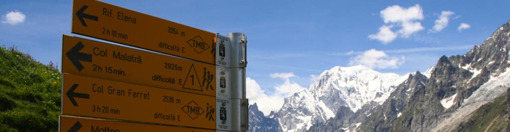
Le Tour du Mont Blanc is French and simply means the Tour of Mont Blanc ('the White Mountain'). Because it's a circular tour, it's also known as the Tour around Mont Blanc or the Mont Blanc circuit. Some people may know it as The Three Countries Tour, as the route travels through three countries on it’s way around Mont Blanc. In daily talk, however, the Tour du Mont Blanc is typically referred to as the "TMB" and that's also what you'll see on many sign posts and way markers along the tour.
In the early days, the valleys around Mont Blanc were inhabited by small farming communities. The farmers were there to take advantage of the rich farm land and had little need, nor wish, to travel deep into the mountains. The farmers would travel to larger villages further down the valley to sell their produce. Traders would make the journey up the valleys from larger towns to sell their various goods to the farmers. In some cases, farmers and traders would cross mountain passes to get to neighbouring valleys.
Then came the time of the early explorers and scientists. In the 18th century, scientists were keen to understand more about the mountains and their glaciers. Due to it’s size and beauty, Mont Blanc attracted a large number of explorers and scientists. Where possible, they would travel on the trails used by the local farmers and traders, and they would link these together to go further and further. In 1767, the Swiss aristocrat and physicist Horace Benedict de Saussure set off from the Chamonix valley with his entourage on a scientific expedition, to complete what is generally credited as the first complete journey around Mont Blanc.
But it was in the Victorian age that things started accelerating. The adventurous Victorians had time and money to travel for pleasure. They had seen the beautiful drawings and read the exciting scientific reports published by the scientists so they wanted to come and experience it first-hand. This was the very early beginning of mountain tourism. Some local farmers turned to mountain guiding and would lead the Victorians, who would often sit comfortably on the back of a mule, along the trails explored by de Saussure.
Since then, mountain tourism has continued to grow in popularity. Today, the Tour du Mont Blanc is probably one of the most popular mountain treks in the world. The route follows parts of the original route taken by de Saussure but has been developed and adapted over the years.
Every commercial outfit will claim to offer the ‘true’, the ‘full’ or the ‘original’ Tour du Mont Blanc route. The truth is that none of the routes today follows exactly the route taken by de Saussure in 1767. The route around Mont Blanc can be cut into daily stages in so many, many ways and a number of route variations can be taken, depending on individual preferences.
Generally speaking, anyone completing the circuit around Mont Blanc will walk in the region of 160 kilometres (100 miles) in distance. Along the way, they’ll tackle around 9000 metres (30,000 feet) of ascent, and the same amount of descent. The journey will take the walkers through no less than three alpine countries (France, Italy and Switzerland) and they’ll hike over eight major mountain passes and into seven major valleys, plus a number of smaller mountain passes and valleys.
The lowest point on the TMB is around 1000 metres (3300 feet) and the highest point on the tour is around 2600 meters (8500 feet). The highest overnight stop is at around 2000 metres (6600 feet).
On average, people hike for 6-8 hours per day and complete the circuit in around ten days of walking.
There really are no rules as to how to complete the TMB. As mentioned, most people do it on foot in about ten walking days. However, many people find it hard to take long vacations so it’s increasingly popular to do it over two holidays of a week each, completing a half circuit each time. Typically, the tour is split into a Western circuit from Chamonix to Courmayeur and an Eastern circuit from Courmayeur to Chamonix. Chamonix and Courmayeur are chosen as start/finish points as they’re easy to get to from Geneva airport and there’s a public bus service between the two villages through the Mont Blanc tunnel. They also make two roughly similar sized tours.
Another way to do it for time-strapped people is to skip certain bits of the tour and go for an ‘Express” or “Highlights” TMB. In this way, the Tour du Mont Blanc can be completed in 6-7 walking days without loosing too much of it’s original feel.
However, people don’t just walk the TMB. More and more people complete the tour on Mountain bike, following roughly the same route as the hikers. There are some tough uphill sections where it’s necessary to carry the bike but the rewards are some spectacularly long descents on amazing trails. A longer tour, making a much bigger circuit and staying on tarmac roads, are available for keen road cyclists.
Finally, it’s worth mentioning the super-fit people who decide to run the Tour du Mont Blanc. Since 2003, the Ultra Trail du Mont Blanc trail running race has drawn trail runners from all over the world to Chamonix to run the 170km and 10,000 metres of positive height gain in semi autonomy. The top runners amazingly complete the circuit in just 20 hours! For the mere mortals, it's more common to run the tour in 3-4 days
Which ever way you do it, you're certain to travel on some of the finest trails and enjoy some of the best mountain views in the world. The Tour du Mont Blanc is an experience of a life-time.
6. Map of the Tour du Mont Blanc:
To hike the Tour du Mont Blanc, you will need good topographic maps. You have a choice of the very detailed 1:25,000 scale maps and a slightly less detailed 1:50,000 scale map.
The 1:25,000 maps are recommended if you are walking the Tour du Mont Blanc independently as you will need to do some navigation each day on the tour, and the additional detail is higly recommended. You will need the following three maps to cover the full TMB:
- 3630 OT Chamonix, issued by the French IGN
- 3531 ET St Gervais, issued by the French IGN
- 107 Monte Bianco, issued by the Italian IGC
The 1:50,000 scale map is good if you prefer to have just one map and don't need the additional detail, for instance if you're using the map to plan your trip or if you are on a guided tour where you don't need to navigate but would like the map to see where you are going each day, or simply as a nice souvenir once you have completed the TMB. We recommend the following 1:50,000 map of the Tour du Mont Blanc:
- A1 Pays du Mont Blanc, issued by the French IGN
Below is a Google map showing the Tour du Mont Blanc:
Our guided and self-guided Tour du Mont Blanc trips follow the following stages.
Stage 1: Chamonix to Les Houches
Our trip starts with a cable car ride that takes us up to nearly 2000 meters. Here, above the tree line, we begin a stunning high level traverse above the Chamonix valley with exceptional views of Mont Blanc. We descend to the village Les Houches and our hotel for the night.
Stage 2: Les Houches to Les Contamines
We hike up through the Les Houches ski area to Col de Voza. We continue upwards, traversing below the Aiguille de Bionnasay and crossing the snout of it's glacier on a suspension bridge, before arriving at the Col de Tricot. It's now steeply downhill to the Miage mountain pasture, where a charming mountain hut sells refreshments, before we continue on the last stretch to Les Contamines.
Stage 3: Les Contamines to Vallee des Glaciers
From Les Contamines we climb steadily up an old roman way towards the top of the Contamines valley. A stunning and wild walk takes us over no less than three mountain passes: Col du Bonhomme, Col de la Croix de Bonhomme and Col de Fours. From the last pass we descend to the small hamlet and dairy farm la Ville des glaciers and the final short stretch to the historic Les Mottets mountain hut.
Stage 4: Vallee des Glaciers to Courmayeur
We leave the Mottets hut and ascend to the Seigne mountain pass, where we cross the border into Italy and get the first views of the dramatic Italian side of Mont Blanc. A gentle descend into the beautiful Val Veny,before another short climb takes us to Col Checrouit and, finally, the descend into Courmayeur. Your evening is free to explore the many bars and restaurants in Courmayeur.
Stage 5 : Courmayeur to Refuge Bonatti From the town center of Courmayeur, we start our climb to the Bertone hut and the Mont de la Saxe ridge. We follow the ridge above the Ferret valley, enjoying breathtaking views of the towering peaks that form the Italian side of Mont Blanc. The night is spend in the splendid Bonatti hut.
Stage 6: Refuge Bonatti to La Fouly From the Bonatti hut, we continue up the Ferret valley. At Arnouva we start the ascend to Grand Col Ferret, pasing the Elena mountain hut on the way. We now enter Switzerland and descend into the idyllic Swiss Ferret valley to the village of La Fouly.
Stage 7: La Fouly to Champex
A gentle day today, starting with a walk down the Ferret valley, along a gushing river and through charming old Swiss farming villages. A relatively short ascent takes us through wood land to the lake side village Champex.
Stage 8: Champex to Trient
Leaving Champex, we hike up the Arpette valley to the notorious Fenêtre d’Arpette - a tiny mountain pass cut into a rugged alpine ridge. This is the highest point of the Tour du Mont Blanc and probably some of the best alpine walking in the world. From the pass we descend to the hamlet Trient.
Stage 9: Trient to Argentiere
From Trient, we hike steadily up to the Balme pass, where we cross the border back into France and the Chamonix valley. We traverse the ridge line of the Aiguilette des Posettes, enjoying breathtaking views in all directions. We descend to the village Argentiere for the night.
Stage 10: Argentiere to Chamonix
We leave Argentiere for the last leg of our tour, ascending to the Aiguilles Rouges nature reserve. A stunning high level walk takes us to the beautiful lac Blanc and some of the finest views in the Alps. All too soon, we commence our final descend to Chamonix and the completion of our tour.
So, there you have it. If you're interested in walking the Tour du Mont Blanc in a guided group or as a self-guided walking holiday, please take a moment to check our guided and self-guided Tour du Mont Blanc trips.
Navigate "Guide to Tour du Mont Blanc"
1. Introduction
2. The name
3. History of the TMB
4. TMB facts and figures
5. Which way to do the TMB
6. Map of the Tour du Mont Blanc
7. TMB stages
View our Tour du Mont Blanc trips
TMB Classic: guided | self-guided
TMB Express: guided | self-guided
TMB West: guided | self-guided
TMB East: guided | self-guided
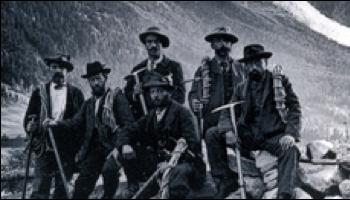
Victorian mountain guides around Mont Blanc
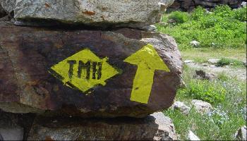
TMB way marker
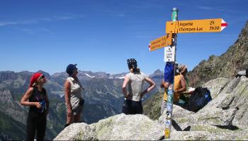
Fenetre d'Arpette (2665m), high point of the Tour du Mont Blanc
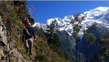
Group above the Chamonix valley on the Tour du Mont Blanc
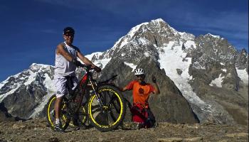
Mountain biking the Tour du Mont Blanc